
“Latitude Hook,” in courtesy of latitudehook.com
Seamen from the Pacific practiced with some of the most primitive orientation tools to trace their voyages from one island to the next. Sailors in carved wooden canoes relied on the latitude hook consisted of two bamboo pieces; one of them was split, with a hook at the end. The other, a pointer was a shorter bamboo stick. The two were tied to one another at a right angle to take advantage of the stars rotating around a fixed point in the sky, the celestial pole from which Polaris could be seen. The navigational device measured the angle between Polaris at the tip of the Little Bear constellation and the horizon. The sailors saw the North Star through the hook ensuring them the course of their trip.
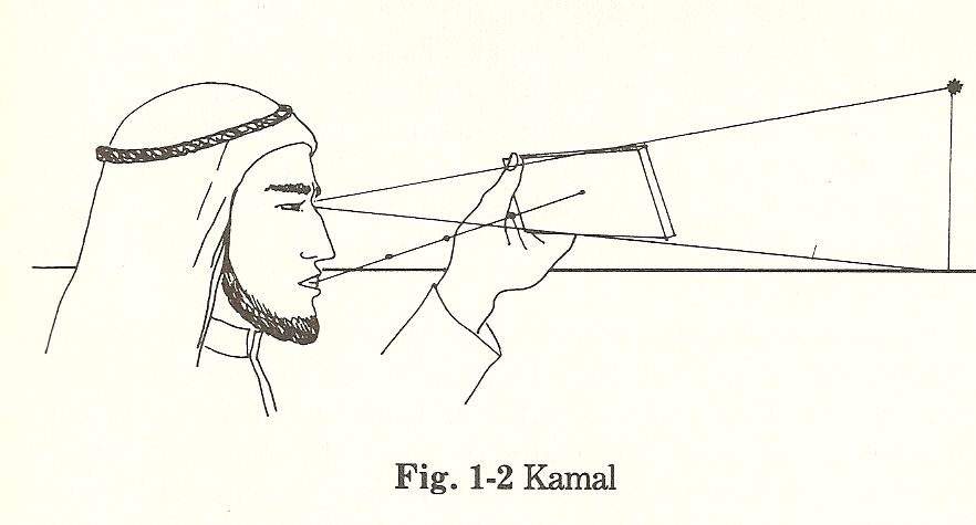
“kamal”, in courtesy of techpanacea.blogspot.com
Far from the Pacific and across the Indian Ocean, Arab mariners recorded trade routes with the “kamal,” translating to the “guide.” The navigation tool consisted of a small wooden board with a hole drilled in the middle of it, and a knotted string that passed through the hole. The different lengths of knotted sting corresponded to different latitudes described by the navigators. It worked on the same principle as the latitude hook, but was more accurate since the string kept the board at a fixed distance from their eyes. The Arabs also took an ancient scientific instrument used by
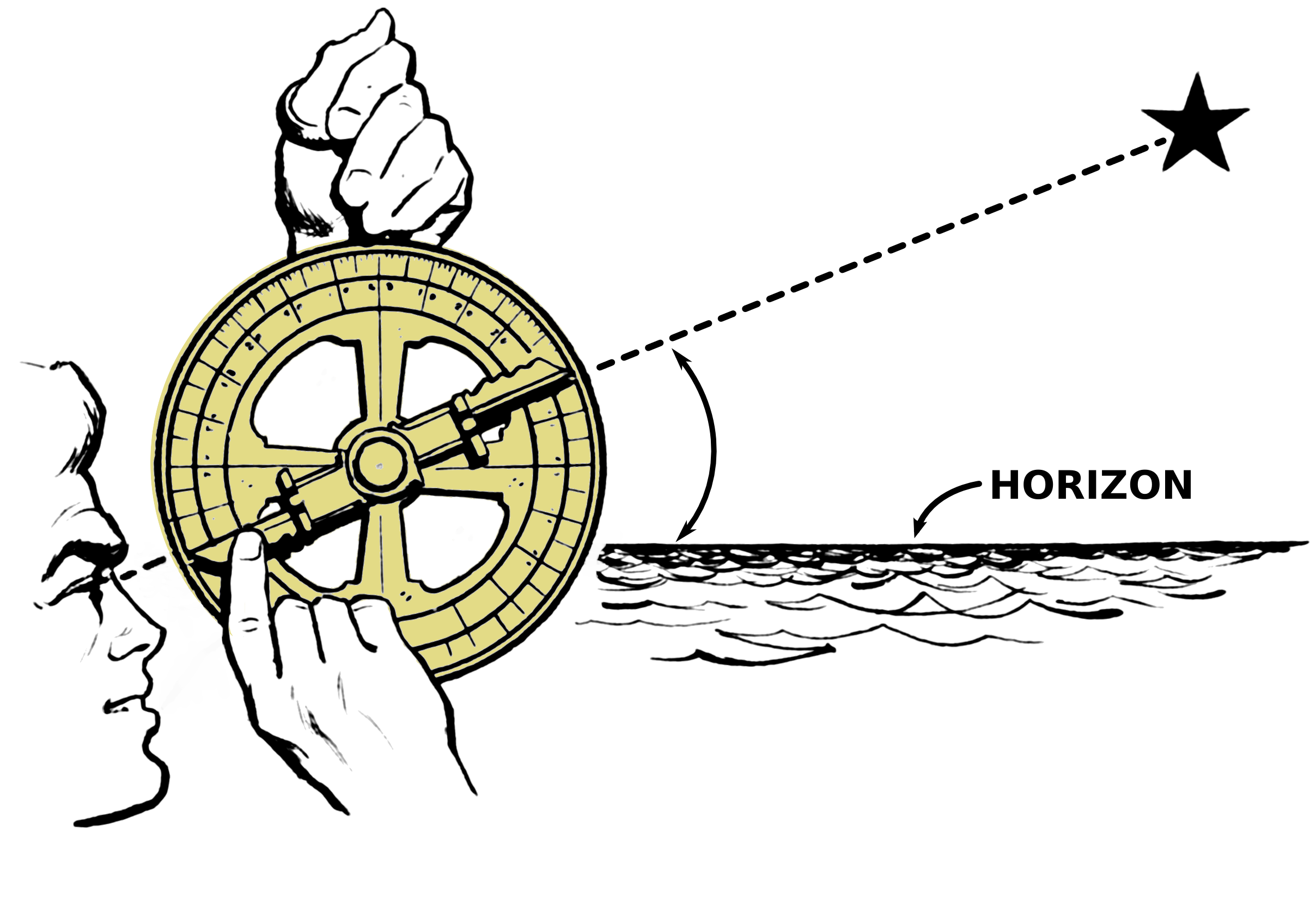
“Astrolabe,” in courtesy of commons.wikipedia.org
the Greeks, the “astrolabe” or “star-taker,” and refined it into a more sophisticated and highly artistic device. Raising the ring from which a brass disk hung, they aligned the abide so that the star they were measuring by was seen in a straight line. The angle of the line of view was then read by the alidade and converted into latitude.
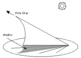
Scandinavian Vikings used the simplest tool to raid and settle on the coasts of the European continent. The sundial, a wooden instrument, kept track of time of sailors’ duty shifts and helped determine ships’ speed. With the discovery of clocks, sundials remained in use to check the accurateness of other clocks on board such as the nocturnal. The old and complex clock consisted of a sight, pointer, and date and hour disks. It used the star’s position to determine the moon’s phase and calculated everything from holidays and sunrises and sunsets to sea tides and the positions of the sun relative to the zodiac. Because the nocturnal depended mostly on Polaris, the brightest star in the northern hemisphere, it served little purpose to southern sailors until the 19th century when the chronometer replaced the device.
“sundial,” in courtesy of www-spof.gsfc.nasa.gov
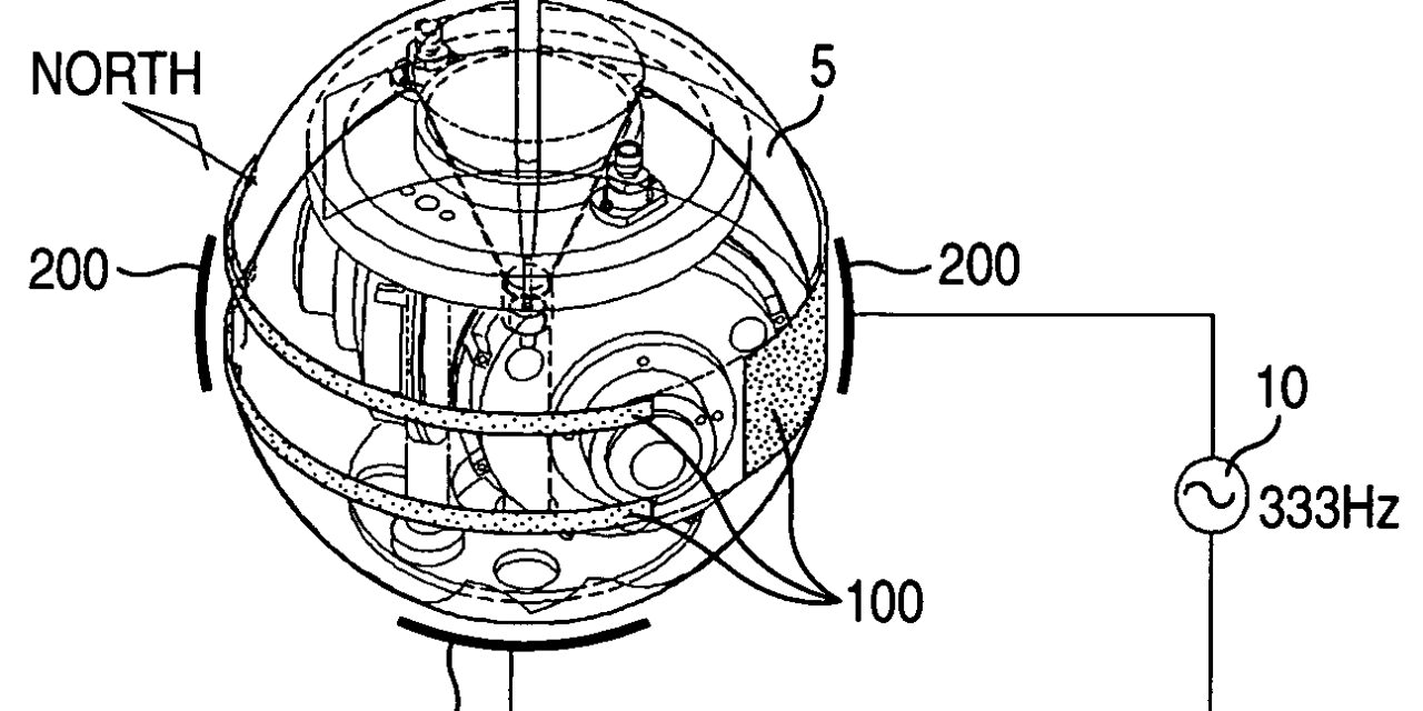
The widespread use of the compass relaxed navigation by sea. The common magnetic compass relied on earth’s magnetic fields to point the arrow in direction to the North Pole. The gyrocompass, on the other hand, was not affected by earth’s magnetism. It used a gyroscope, a device whose axel aligned itself parallel with the north-south line or the earth’s rotation axis. Thus a gyrocompass always pointed north and was immune to any magnetism errors that a conventional compass suffered. Today compasses are equipped with a GPS system that provide information about the device’s location. But the technology only records speed information rather than direction information.
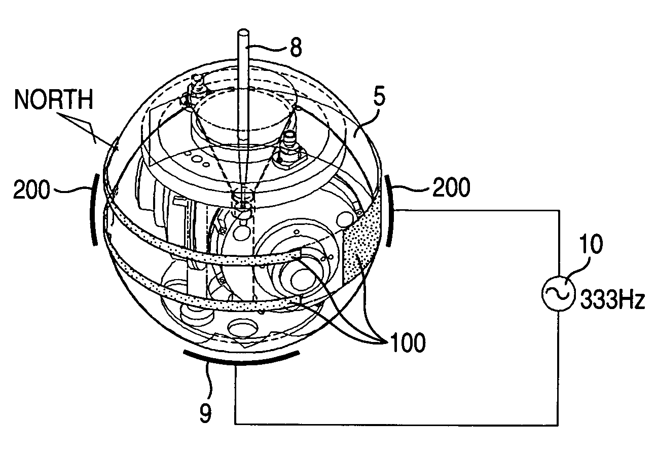
“gyrocompass,” in courtesy of www.freepatentsonline.com
Like their predecessors, seamen continue to muster enough courage to navigate their way by the lovely northern stars. On long voyages into the open see, the simplest tools of guidance point them in the right direction.


